Why Choose an Industrial Quadcopter for Your Business?
Choosing an Industrial Quadcopter can change how a business observes assets, measures risk, and responds to costly problems. It is not simply a flying camera. It is a field tool that combines accurate sensors, stable flight, and actionable data.
On a construction site, one aircraft can inspect roof sections before workers climb ladders. On a farm, it can reveal dry crop patches through multispectral imaging. In a warehouse, it may scan high structures without interrupting daily operations. These details can reduce inspection time and improve maintenance planning.
The equipment still demands careful judgment. Weather, battery limits, signal strength, and operator training affect every mission. Some businesses buy advanced drones before defining a useful workflow. That is an expensive mistake. The best platform should match the site, payload, software, and reporting process.
Colin Snow, founder of Drone Analyst, has said, “The value of a drone is not in the drone itself, but in the data it collects.” This principle remains highly practical. A capable Industrial Quadcopter matters only when its information supports safer decisions, clearer records, or measurable savings.
Consider the entire operation. Who prepares the flight plan? Who reviews the images? Who acts on the findings? Weak answers expose hidden costs. Strong answers create repeatable value.
This guide examines those questions closely. It also recognizes an uncomfortable truth: drones cannot fix poor processes. They can expose them.
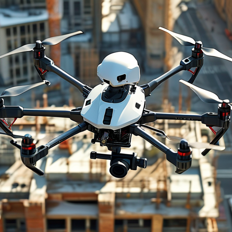
Defining Industrial Quadcopters: 2–10 kg Payloads and 20–50-Minute Flights
An industrial quadcopter is built for measurable work, not casual photography. Its practical definition often includes a 2–10 kg payload and 20–50-minute flight time. Payload means usable cargo after accounting for the aircraft, batteries, and safety equipment. That distinction matters. A 10 kg lifting claim may apply only in calm, controlled conditions. Wind, temperature, altitude, and battery age can reduce capacity quickly.
Grand View Research valued the global commercial drone market at approximately USD 30.61 billion in 2023. It also forecasts a 13.9% compound annual growth rate from 2024 to 2030. Drone Industry Insights’ 2024 Commercial Drone Market Report identifies inspection, mapping, and logistics as major growth areas. These tasks require stable lifting performance and repeatable endurance. A 20-minute flight may support a short site check. A 50-minute flight can reduce battery changes across larger facilities.
Field testing should use the full payload, not an empty-aircraft figure. Operators should record wind speed, takeoff weight, battery cycles, and return reserves. The advertised range is only a starting point. In practice, a quadcopter carrying 2 kg may fly very differently from one carrying 10 kg. That gap is easy to overlook. It deserves honest testing before purchasing.
Why Choose an Industrial Quadcopter for Your Business? - Defining Industrial Quadcopters: 2–10 kg Payloads and 20–50-Minute Flights
| Specification or Business Factor | Typical Range or Capability | Why It Matters to a Business |
|---|---|---|
| Payload capacity | Approximately 2–10 kg | Supports professional cameras, LiDAR units, multispectral sensors, loudspeakers, spotlights, and compact delivery loads. |
| Flight endurance | Approximately 20–50 minutes per battery cycle | Provides enough time for inspection routes, mapping passes, emergency assessment, or repeated lifting operations before landing to recharge or change batteries. |
| Payload-to-endurance trade-off | Higher payload generally reduces flight time | Mission planning can balance sensor weight, battery capacity, route length, and required reserve power. |
| Typical takeoff mass | Roughly 8–30 kg, including battery and payload | The aircraft is large enough for heavier equipment but remains more compact and maneuverable than many heavy-lift multirotors. |
| Motor and rotor configuration | Four motors and four rotors; often with redundant flight-control and power-monitoring systems | The simple airframe can reduce mechanical complexity, maintenance points, and transport requirements compared with larger rotor configurations. |
| Wind operating capability | Commonly designed for approximately 8–12 m/s sustained wind, depending on configuration | Improves the reliability of outdoor inspections and surveys, although operators must still follow site-specific weather limits. |
| Weather protection | Many professional systems offer rain and dust protection; commonly expressed through an IP rating | Helps protect electronics during field work, but an IP rating does not automatically mean the aircraft is safe to operate in every rainfall condition. |
| Sensor integration | Gimballed RGB cameras, thermal cameras, LiDAR, multispectral cameras, and zoom payloads | One aircraft can support multiple workflows, including asset inspection, surveying, vegetation analysis, public safety, and progress documentation. |
| Positioning and navigation | GNSS-assisted flight, inertial navigation, altitude sensing, and obstacle detection on many systems | Supports repeatable routes, stable hovering, automated mapping, and safer operation near structures when properly configured. |
| Data and communications | Digital command links with live video and telemetry; practical range depends on regulations and local radio conditions | Enables real-time supervision, rapid decision-making, and immediate quality checks during field operations. |
| Operational efficiency | Rapid deployment with fewer ground resources than many traditional inspection methods | Can reduce work-at-height exposure, traffic disruption, inspection time, and the need for scaffolding or heavy access equipment. |
| Best-fit business applications | Power-line and infrastructure inspection, construction surveying, mining, agriculture, emergency response, and industrial site monitoring | The combination of lift capacity, endurance, and sensor flexibility makes the platform suitable for recurring, data-intensive field missions. |
| Compliance and safety planning | Requires trained operators, airspace checks, maintenance records, risk assessments, and compliance with local aviation rules | A compliant operating program protects personnel, assets, collected data, and the continuity of commercial operations. |